At it’s heart the art of cartography is thousands of small decisions- about where to place labels, which features to label, which font and what size to use, or how to symbolize different types of geographic and cultural features. There are standards of course but there is so much room for expression within the standard.
When you make several of the same type of map the number of those decisions is drastically reduced and the process becomes less artistic and more formulaic. I still love the challenge of fitting all the information in the given space in the best way possible, but after a few years of doing that we were itching to get back to the creative side of cartography.
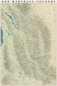
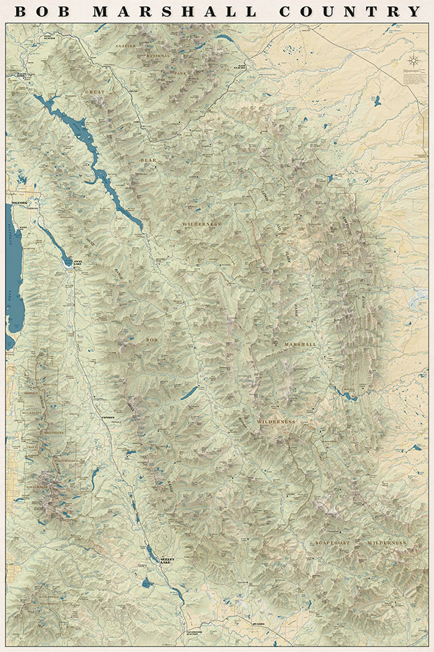
We have talked about (and received requests for) a map with the whole Bob Marshall Wilderness Complex since 2011 when we printed our first map. This spring the concept for that map finally started to take shape. We knew we wanted it to be totally functional so you could use it to daydream about new trips or reminisce about trips passed. We also wanted it to be an art piece- something that would look good in a frame on someone’s wall.
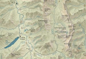
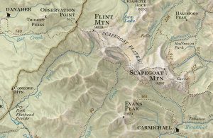
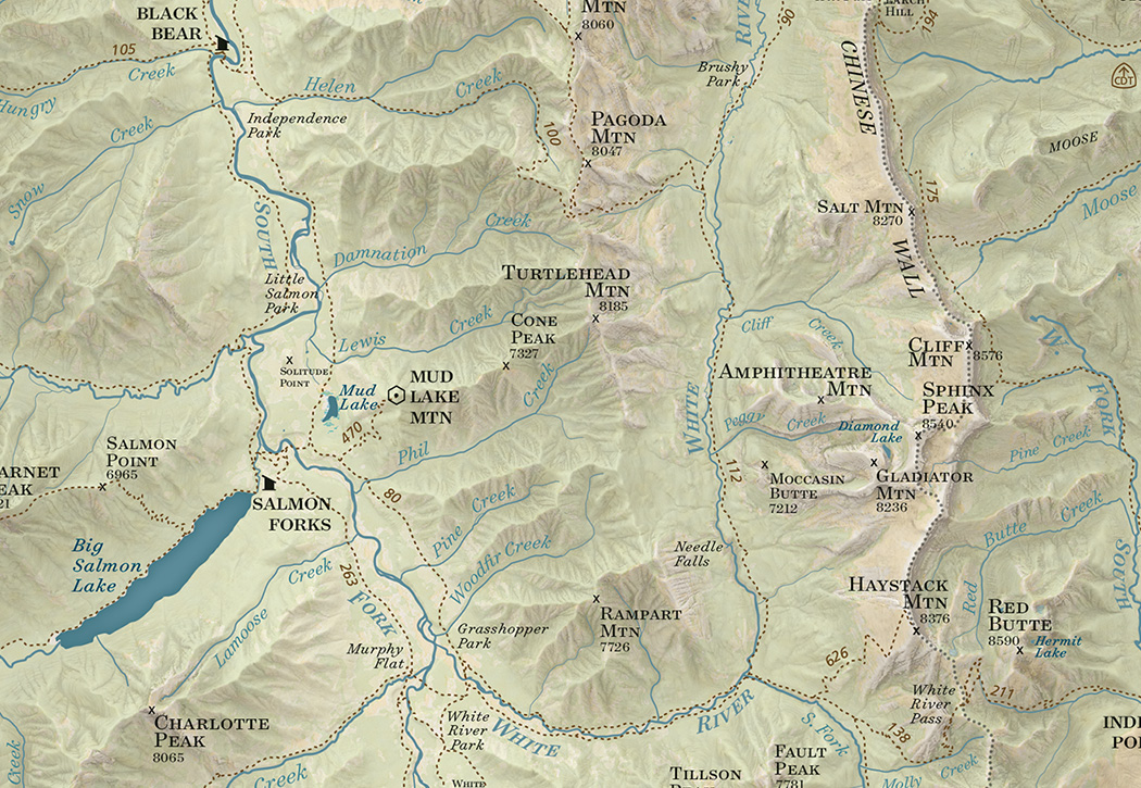
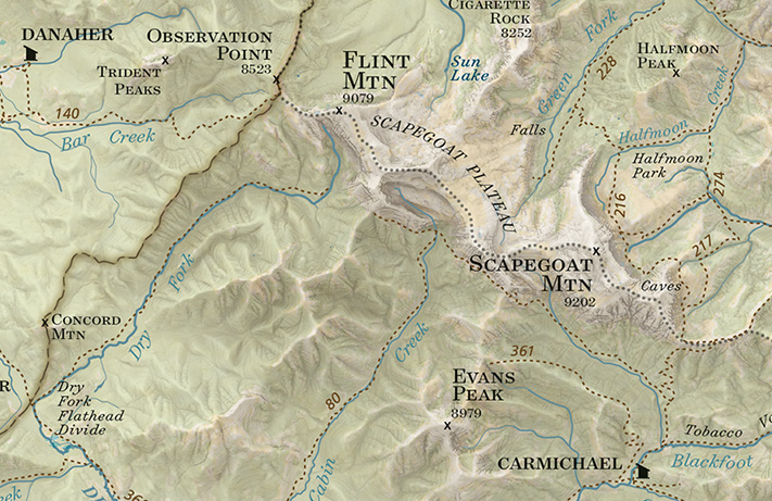
On the map you will find all the trails, cabins, trailheads, and ranger stations plus all the peaks, streams, rivers and geographic features that are on our other maps all overlaid on an updated terrain shading.
We are really pleased with how the map turned out and we had a lot of fun making it!
It also turns out when you put the entire Bob Marshall on one rectangular sheet of paper you end up with the entire Mission Range and Rattlesnake Wilderness on the page as well!
The whole map!
Have you been using our South Half of the Bob Marshall map? We’re getting ready to print a second edition and we want to hear from you. Have you found any mistakes? We’re looking for anything from mis-named peaks or trails to spelling errors. Shoot us an email at info@cairncarto.com and let us know!
I joked last night that having a map that we made on TV is pretty dorky- it would be cool if one of us were actually on TV, or even our dog (we don’t have a dog, but if we did, that would probably be cooler than a map…)
But, we’re still excited that some maps we made will be featured in a Montana PBS special about Smoke Elser, an outfitter in the Bob Marshall Wilderness. I mean, it’s pretty exciting that the “Bob” is on TV to begin with, it’s just bonus that they used our maps! We made an overview map of western Montana and a close-up of the Danaher area. For those of you who have seen our map of the South Half of the “Bob,” the Danaher map will look familiar, we just made a couple changes to the map we published. It will air several times. Look for it Tonight at 7pm, Thursday 11/24 at 3pm, Tuesday 11/29 at 7:45pm, Thursday 12/29 at 7pm and Saturday 12/31 at 4:30pm
Now we just need to track down someone with a TV so we can watch it!
you can read more about the special here: http://www.montanapbs.org/3MilesAnHour/