At it’s heart the art of cartography is thousands of small decisions- about where to place labels, which features to label, which font and what size to use, or how to symbolize different types of geographic and cultural features. There are standards of course but there is so much room for expression within the standard.
When you make several of the same type of map the number of those decisions is drastically reduced and the process becomes less artistic and more formulaic. I still love the challenge of fitting all the information in the given space in the best way possible, but after a few years of doing that we were itching to get back to the creative side of cartography.
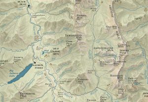
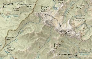
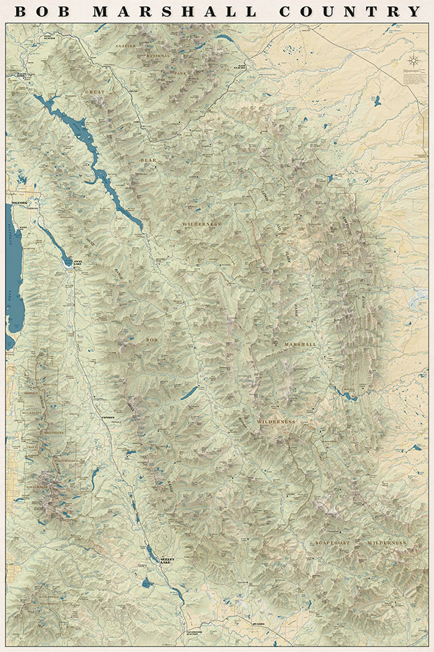
We have talked about (and received requests for) a map with the whole Bob Marshall Wilderness Complex since 2011 when we printed our first map. This spring the concept for that map finally started to take shape. We knew we wanted it to be totally functional so you could use it to daydream about new trips or reminisce about trips passed. We also wanted it to be an art piece- something that would look good in a frame on someone’s wall.
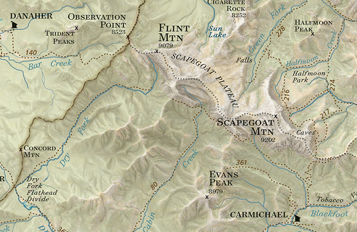
On the map you will find all the trails, cabins, trailheads, and ranger stations plus all the peaks, streams, rivers and geographic features that are on our other maps all overlaid on an updated terrain shading.
We are really pleased with how the map turned out and we had a lot of fun making it!
It also turns out when you put the entire Bob Marshall on one rectangular sheet of paper you end up with the entire Mission Range and Rattlesnake Wilderness on the page as well!
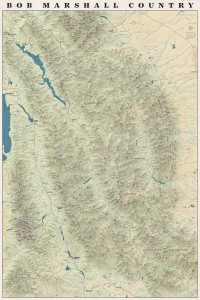
The whole map!
Every spring since 2011 it has been our goal to have a map finished and printed and on its way to customers by April. Our track record hasn’t been very good though- we’ve printed in June, July and last year in September. This year we really buckled down and we went to press the last week in March and it feels so good to be writing this new map announcement before the high country trails have even started to dry out and folks are still planning summer adventures.
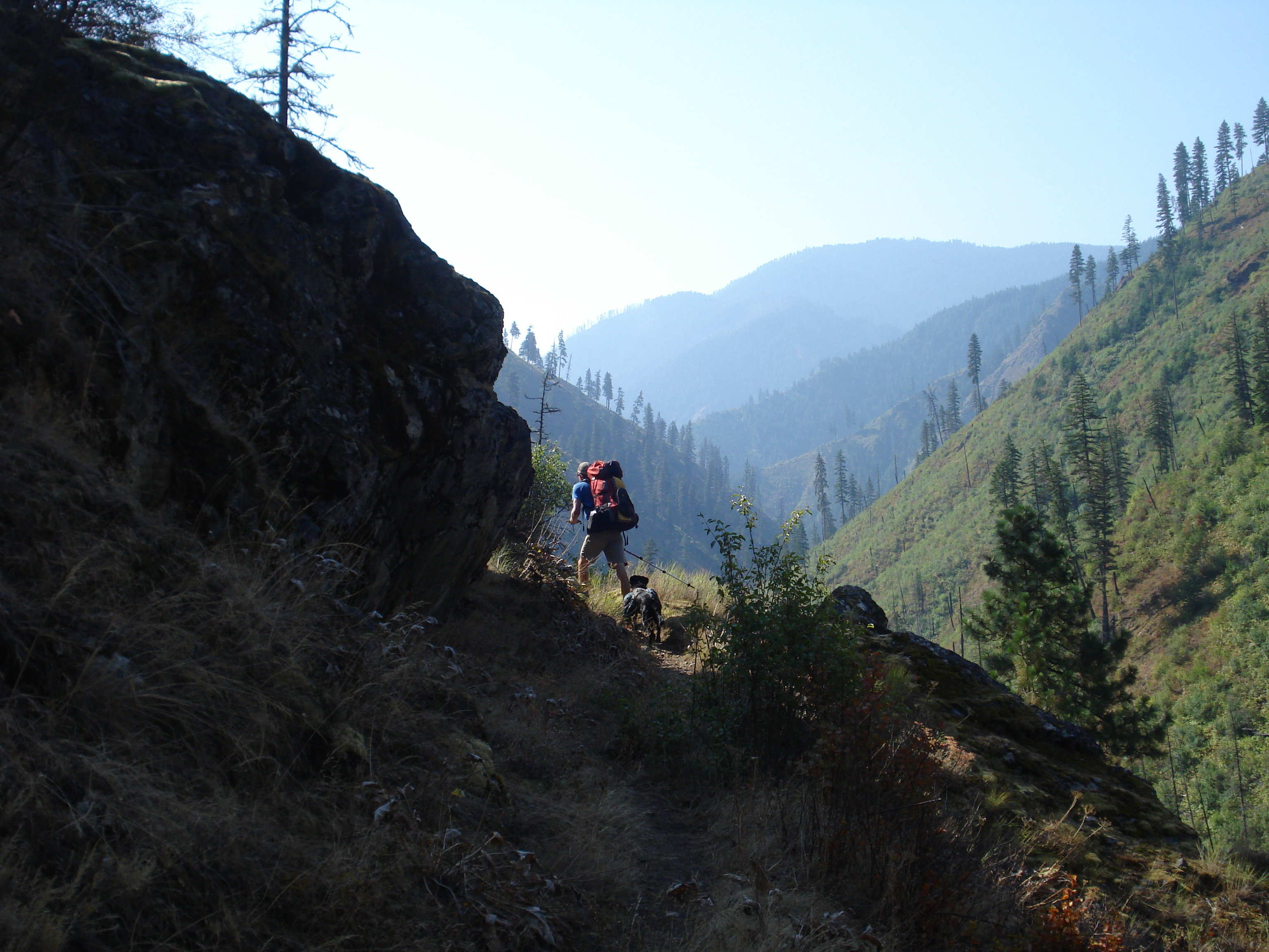
The South Half of the Selway Bitterroot surprised us with how remote it feels and how varied the terrain is. From the highest peaks in the Bitterroot Range to sandy beaches on the Selway River there is a little of everything. As the crow flies a lot of the terrain looks like it isn’t too far from the nearest road- but when that road is the Magruder corridor road, or even Highway 12 a nearby by road doesn’t necessarily mean close proximity to civilization. Highway 12 might be one of the few federal highways in the lower 48 where you can drive over 100 miles without cell service!
Below are some pictures of our favorite places from this map. You can order it now from our website or pick one up at your favorite outdoor retailer in western Montana.
Watchtower Creek was one of our favorite hikes of the whole summer- awesome scenery, TONS of huckleberries and a good trail
The Montana/Idaho divide trail follows the state line north and south of Nez Perce pass through some beautiful meadows and ridges
Piper relaxing after a swim at Glen Lake- a great hike for kids with spectacular views
Green Mountain Lookout has views into the Selway Bitterroot and Frank Church in all directions
Some meadows just off the Magruder Road near Poet Creek. This is a section of the old Nez Perce Indian Trail
The view toward the Bitterroots from Spot Mountain Lookout. It’s five thousand feet in about six miles from the road to Paradise up to this lookout and you can see wilderness in every direction from the top.
There are countless steep ridges above the Selway River, this is the view from the ridge above Paradise Guard station near the put-in for the wilderness float section of the Selway River
Piper and Jamie on the ridge above Paradise
Copper Butte near Indian Hill high above the Selway River. Grassy ridges for days
Near Buck Peak- we spent five days backpacking in this area and didn’t see a single other person
Fall camping at Buck Lake- we tend to avoid camping on lakes during the summer because of Mosquitos but in late September they are beautiful!
“A wilderness, in contrast with those areas where man and his own works dominate the landscape, is hereby recognized as an area where the earth and its community of life are untrammeled by man, where man himself is a visitor who does not remain.” -The definition of Wilderness as stated in the 1964 Wilderness Act
I’ve spent most of the last two weeks visiting family and friends in the Northeast. Explaining what I do tends to be a little more involved in the Northeast because most people don’t have as thorough an understanding of federal land management as they do in the Rocky Mountain West. When I say I make maps of Wilderness areas I usually have to explain how a Wilderness area (capital “W”) is different than a National Park and usually contained within National Forest. The scale can be hard for people to wrap their heads around- some of the areas we are making maps of in Montana are bigger than the smaller New England states!
My explanation usually goes something like this: Wilderness is land within other public land that is set aside to remain “untrammeled.” The use of mechanized vehicles including bicycles is forbidden and the trails and infrastructure are maintained with traditional hand tools. In Montana most Wilderness areas are within National Forest Land and managed by the National Forests but they can also be managed by other agencies. Portions of many National Parks are managed as Wilderness but Wilderness areas are not managed like National Parks.
This week is the 50th anniversary of the Wilderness Act and all summer long events and articles have celebrated the anniversary. We are big proponents of any type of designation that protects wild places but our biggest loves are the huge Wilderness areas in western Montana. We are celebrating the anniversary of the Wilderness Act and the release of our newest map by offering 20% off all of our maps for this week only. So stock up!
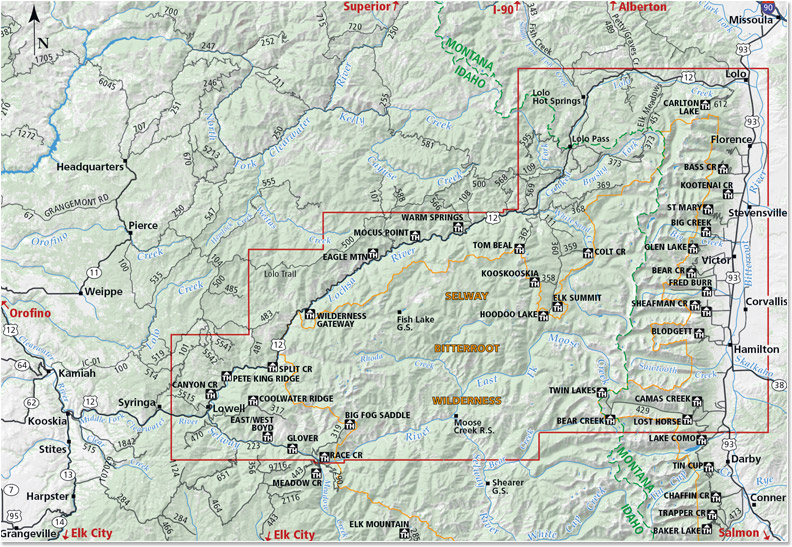
We are so excited to announce the release of our fifth map- The North Half of the Selway-Bitterroot Wilderness! This map straddles the Montana-Idaho border and covers well over half of the Selway Bitterroot Wilderness. This is a spectacular area and we had some amazing experiences while we were out gathering data for this map. Grab a copy and head out there!
Included on the map:
Highway 12 from Lolo, Montana to Lowell, Idaho
Highway 93 from Lolo, Montana to the Lost Horse Road
The Bitterroot Range from Lolo Peak South to the Twin Lakes Trailhead and the Lost Horse area
Bitterroot Canyons between Hamilton and Lolo Including Blodgett and Kootenai Creeks
The Selway Road from Highway 12 in Lowell to Race Creek Trailhead
The Selway River from the Confluence with the Clearwater upstream to Moose Creek
Moose Creek Ranger Station
Elk Summit area
Jerry Johnson, Stanley and Weir hot springs
Map SampleArea CoveredA hike down the Selway River trail #4 is not to be missed!