


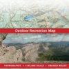
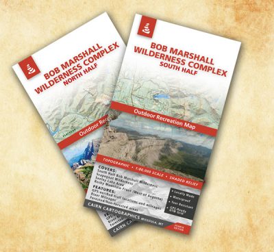
Bob Marshall Wilderness Complex: South Half
$15.95
Covers:
- South half of The Bob Marshall Wilderness Complex
- Entire Scapegoat Wilderness
- Seeley Lake area (east of highway 200)
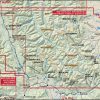
- Rocky Mountain Front (near Augusta)
- Chinese Wall
- South Fork Flathead River- Youngs/Danaher confluence to Black Bear cabin
Features:
Waterproof, tear-resistant plastic
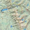
Topographic / shaded relief
Forested and non-forested areas
GPS verified trail locations and mileages
River mileages for South Fork Flathead River
UTM and Lat/Long grids
1:85,000 scale
Contour interval: 100 feet
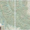
This map covers the South half of the complex from the Seeley/Swan valley on the West to the Rocky Mountain Front and Augusta on the East. During the summer and fall of 2010, we GPS’ed over 675 miles of trail to make the trail locations and mileages as accurate as possible. We hope you’ll find these additions useful on your next trip into the Bob. Fifth Edition, printed in spring 2021.
Unfolded maps are available. Please contact us if you’re interested in purchasing an unfolded map.
Avenza Maps
This map is also available in the Avenza Maps app as a geospatial PDF. Note that this is a separate purchase than the printed map shown above.

Be the first to review “Bob Marshall Wilderness Complex: South Half”
Related products
Reviews
There are no reviews yet.